
The Department of Disaster Management has reported that its regional partner, the Antigua and Barbuda Meteorological Services is closely monitoring the progress of a potential tropical cyclone that could be in or near the area of the Leeward Islands and the British Virgin Islands by late this upcoming weekend.
Based on the forecast model tracks, the system could be at the nearest point to the area late Friday or Saturday. By that time, it could be a hurricane.
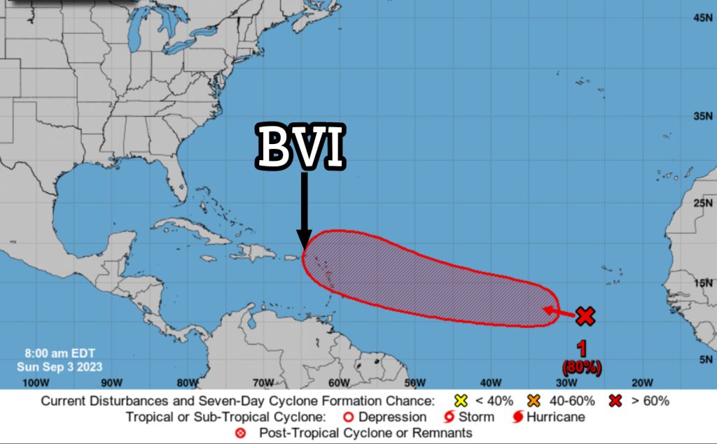
The tropical disturbance, designated as AL95, was still very far away, about 2174 miles east-southeast of the Leeward Islands, moving west to west-northwest at 18 mph, at the time of the report.
Maximum sustained winds were near 35 mph with higher gusts. Strengthening is forecast during the next several days and the disturbance has a 60 per cent chance of becoming a tropical cyclone in 48 hours and a 90 per cent chance in seven days.
While there is a high level of confidence that AL95 will develop into a tropical cyclone, the forecast track remains highly uncertain due to its far distance from the islands. However, the DDM cautions that a majority of model forecasts indicate that the centre of what is anticipated to be at least a tropical storm will likely pass to the north of the islands. Hence, at this early stage, the reasonable worst-case scenario suggests that AL95 poses little threat to the islands.
To ensure your safety, The DDM strongly recommends having your hurricane disaster plan prepared and ready.
Please note that no alerts, watches or warnings are currently in effect for the area; however, an alert is likely by Tuesday night. Residents are asked to closely monitor tropical cyclone information statements issued by the Antigua and Barbuda Meteorological Services until further notice.